West End Airport
West End Airport | |||||||||||||||
|---|---|---|---|---|---|---|---|---|---|---|---|---|---|---|---|
| Summary | |||||||||||||||
| Airport type | Private | ||||||||||||||
| Owner/Operator | Old Bahama Bay Resort | ||||||||||||||
| Serves | Grand Bahama | ||||||||||||||
| Location | West End, Bahamas | ||||||||||||||
| Elevation AMSL | 5 ft / 2 m | ||||||||||||||
| Coordinates | 26°41′07″N 078°58′30″W / 26.68528°N 78.97500°W | ||||||||||||||
| Website | www.oldbahamabayresorts.com | ||||||||||||||
| Map | |||||||||||||||
 | |||||||||||||||
| Runways | |||||||||||||||
| |||||||||||||||
Source: Great Circle Mapper[1] | |||||||||||||||
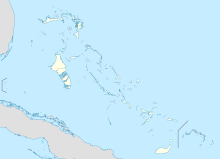
West End Airport (IATA: WTD, ICAO: MYGW) is an airport that serves Grand Bahama.[2] While smaller than the other airport on the island located in Freeport, this airport has a paved runway 7,999 feet in length as well as onsite customs and immigration. This airport currently serves private planes and charters. The airport features the westernmost runway in the entire Bahamian archipelago.
History
[edit]
The airport was constructed as part of an ambitious plan to construct a 1000-guest resort at West End in the late 1940s by the British firm Butlin's. The partially-constructed resort operated for a single season in 1950 before Butlin's ran out of money. A small part of the resort was brought back into operation in 1955 before being more fundamentally redeveloped in 1960. West End Airport was the main airport for Grand Bahama until Freeport's overshadowed it.
According to its route map, in 1971 Northeast Airlines was operating scheduled passenger jet service nonstop between Boston (BOS) and the airport.[3][4]
References
[edit]- ^ Airport information for MYGW at Great Circle Mapper.
- ^ Airport guide
- ^ "Northeast Airlines August 1971 Route Map". www.departedflights.com. Retrieved 2024-01-23.
- ^ "First Flight from Boston to West End, Grand Bahama - Special Cover Signed co-signed by: Captain H. A. Cook | HistoryForSale Item 287859".

