
Sadwal Kalan
This article needs additional citations for verification. (October 2024) |
Sadwal Kalan
سدوال کلاں | |
|---|---|
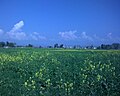
 Countryside around Sadwal Kalan | |
| Coordinates: 32°50′30.69″N 74°06′29.81″E / 32.8418583°N 74.1082806°E | |
| Country | |
| Province | Punjab |
| Region/Division | Gujrat |
| District | Gujrat |
| Tehsil | Kharian |
| Government | |
| Time zone | UTC+5 (PST) |
| Postal Code | 50991 |
| Area code | 053 |
Sadwal Kalan is a village located in the Gujrat District of Punjab, Pakistan. It is situated approximately 3 kilometres east of Kotla, 38 kilometres from Gujrat, and about 30 kilometres from Kharian Tehsil.[1] The village falls under the jurisdiction of Union Council Kakrali, which is just 4 kilometres to the north, with the border of Azad Kashmir lying roughly 10 kilometres further north. The majority of Sadwal Kalan’s population are Jat Muslim, contributing to its distinct cultural identity.
Gallery
[edit]-
 Crops of Bajra
 -
 Nice View of Flowers of Mustard(Sarsoon)
 -
 Flowers of Mustard in Kaalian
 -
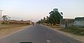 Sadwal Road New
 -
 A view of Mustard Flower Near Daali
 -
 Street Towards Pindi
 -
 Street Towards Pindi Awan


Neighbour villages
[edit]References
[edit]This article about a location in Gujrat District, Punjab, Pakistan is a stub. You can help Wikipedia by expanding it. |