
File:Stadt Moers Park - geograph.org.uk - 113680.jpg
No higher resolution available.
Stadt_Moers_Park_-_geograph.org.uk_-_113680.jpg (640 × 480 pixels, file size: 61 KB, MIME type: image/jpeg)
| This is a file from the Wikimedia Commons. Information from its description page there is shown below. Commons is a freely licensed media file repository. You can help. |
Summary
| Description |
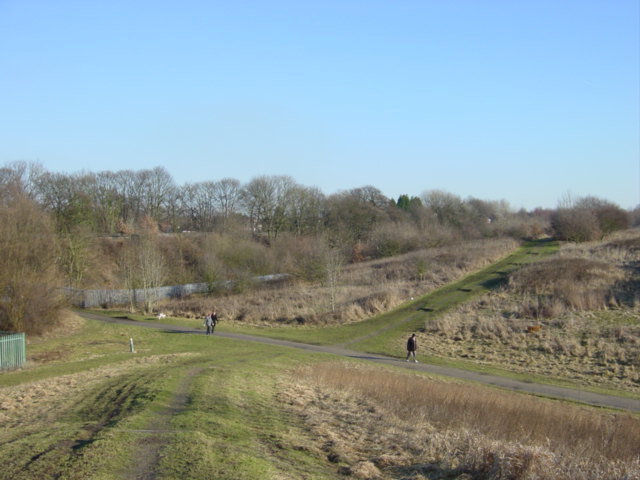
English: Stadt Moers Park. This part of Stadt Moers Park is called Tushingham after Henry Tushingham who founded a brickworks here in the 1890's, the bricks being made from locally extracted clay and shale. Prior to this there had been a colliery on the land. The brickworks closed in the 1970's and the land was sold to Knowsley council who used it as a landfill site until 1983 when it was decided to reclaim the land and transform it into a country park. The park is accessed by a tunnel beneath the Liverpool to Manchester railway line which can be seen to the left of the photo. |
| Date | |
| Source | From geograph.org.uk |
| Author | Sue Adair |
| Attribution (required by the license) | Sue Adair / Stadt Moers Park / |
| Object location | | View this and other nearby images on: OpenStreetMap |
|---|
_&language=en)
Licensing

|
This image was taken from the Geograph project collection. See this photograph's page on the Geograph website for the photographer's contact details. The copyright on this image is owned by Sue Adair and is licensed for reuse under the Creative Commons Attribution-ShareAlike 2.0 license.
|
This file is licensed under the Creative Commons Attribution-Share Alike 2.0 Generic license.
Attribution: Sue Adair
- You are free:
- to share – to copy, distribute and transmit the work
- to remix – to adapt the work
- Under the following conditions:
- attribution – You must give appropriate credit, provide a link to the license, and indicate if changes were made. You may do so in any reasonable manner, but not in any way that suggests the licensor endorses you or your use.
- share alike – If you remix, transform, or build upon the material, you must distribute your contributions under the same or compatible license as the original.
- Remove redundant categories and try to put this image in the most specific category/categories
- Remove this template
- The location categories are based on information from this geonames tool and this OpenStreetMap tool combined with a database. You can also have a look at this tool from mysociety.
- The topic category from Geograph was Industrial heritage (find similar images heritage at Geograph)
File history
Click on a date/time to view the file as it appeared at that time.
| Date/Time | Thumbnail | Dimensions | User | Comment | |
|---|---|---|---|---|---|
| current | 12:29, 31 January 2010 | | 640 × 480 (61 KB) | GeographBot | == {{int:filedesc}} == {{Information |description={{en|1=Stadt Moers Park. This part of Stadt Moers Park is called Tushingham after Henry Tushingham who founded a brickworks here in the 1890's, the bricks being made from locally extracted clay and shale. |
File usage
The following page uses this file: