
File:Puerto Rico map with urban areas, some communities and bodies of water.svg

Size of this PNG preview of this SVG file: 800 × 331 pixels. Other resolutions: 320 × 132 pixels | 640 × 265 pixels | 1,024 × 423 pixels | 1,280 × 529 pixels | 2,560 × 1,058 pixels | 1,004 × 415 pixels.
Original file (SVG file, nominally 1,004 × 415 pixels, file size: 7.19 MB)
| This is a file from the Wikimedia Commons. Information from its description page there is shown below. Commons is a freely licensed media file repository. You can help. |
Summary
| Description |
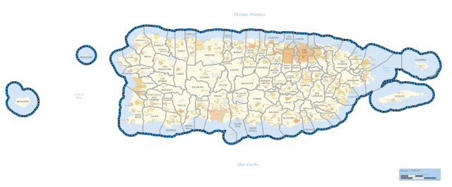
English: Puerto Rico map with urban areas, communities and bodies of water
Español: Fuente: Base de datos MAF/TIGER de la Oficina del Censo de los Estados Unidos (TAB10)
Proyección: Puerto Rico-based Albers Equal Area |
| Date | |
| Source | https://www2.census.gov/geo/maps/cong_dist/cd115/st_cdgov/CD115_PR_Gov_sp.pdf |
| Author | US Census |
Licensing
This image or file is a work of a United States Census Bureau employee, taken or made as part of that person's official duties. As a work of the U.S. federal government, the image is in the public domain.
|
 |
File history
Click on a date/time to view the file as it appeared at that time.
| Date/Time | Thumbnail | Dimensions | User | Comment | |
|---|---|---|---|---|---|
| current | 21:06, 28 August 2021 | | 1,004 × 415 (7.19 MB) | The Eloquent Peasant | Uploaded a work by US Census from https://www2.census.gov/geo/maps/cong_dist/cd115/st_cdgov/CD115_PR_Gov_sp.pdf with UploadWizard |
File usage
The following page uses this file: