
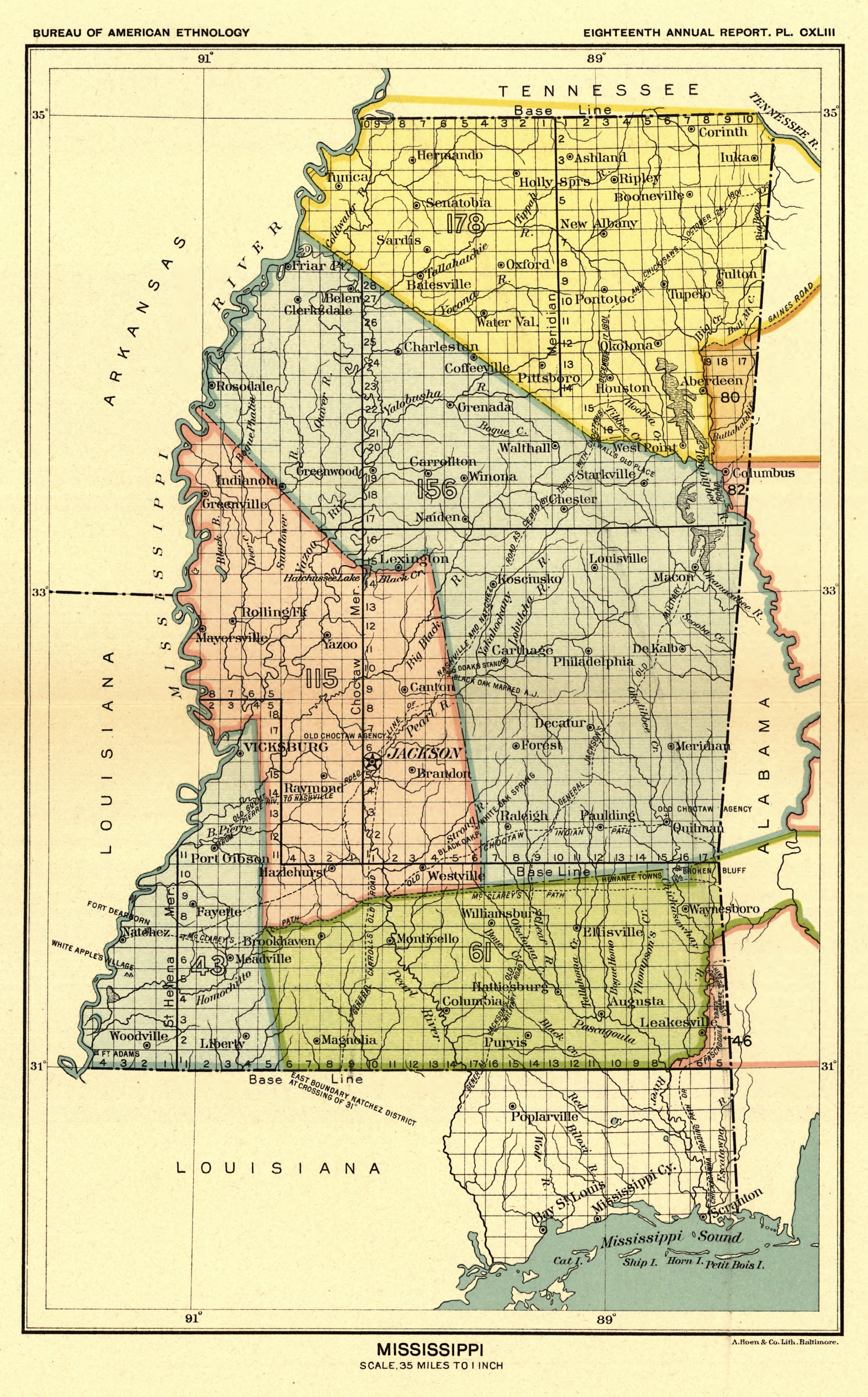
File:Map from Indian land cessions in the United States by Charles C. Royce 11.jpg
Size of this preview: 372 × 598 pixels. Other resolutions: 149 × 240 pixels | 298 × 480 pixels | 477 × 768 pixels | 636 × 1,024 pixels | 2,131 × 3,428 pixels.
Original file (2,131 × 3,428 pixels, file size: 2.9 MB, MIME type: image/jpeg)
| This is a file from the Wikimedia Commons. Information from its description page there is shown below. Commons is a freely licensed media file repository. You can help. |
Summary
| Description |
English: Map from Indian land cessions in the United States by Charles C. Royce |
||
| Date | |||
| Source |
|
||
| Author | Charles C. Royce, Indian land cessions in the United States |

Licensing
| This work is from the Library of Congress. According to the library, there are no known copyright restrictions on the use of this work. |  |
| Annotations | This image is annotated: View the annotations at Commons |
File history
Click on a date/time to view the file as it appeared at that time.
| Date/Time | Thumbnail | Dimensions | User | Comment | |
|---|---|---|---|---|---|
| current | 15:50, 3 September 2023 | | 2,131 × 3,428 (2.9 MB) | Jengod | Crop |
| 19:08, 15 April 2023 |  | 3,297 × 4,256 (4.2 MB) | Jengod | Uploaded a work by Charles C. Royce, Indian land cessions in the United States from {{LOC-image|division=gmd|id=g3701em.gct00002}} with UploadWizard |
File usage
The following pages on the English Wikipedia use this file (pages on other projects are not listed):