File:Laurel Hill cemetery 20190328140302.jpg
Page contents not supported in other languages.
Tools
Actions
General
In other projects
Appearance
Size of this preview: 800 × 442 pixels. Other resolutions: 320 × 177 pixels | 640 × 353 pixels | 1,024 × 565 pixels | 1,280 × 706 pixels | 3,533 × 1,950 pixels.
Original file (3,533 × 1,950 pixels, file size: 2.85 MB, MIME type: image/jpeg)
This is a file from the Wikimedia Commons. Information from its description page there is shown below. Commons is a freely licensed media file repository. You can help. |
Summary
DescriptionLaurel Hill cemetery 20190328140302.jpg |
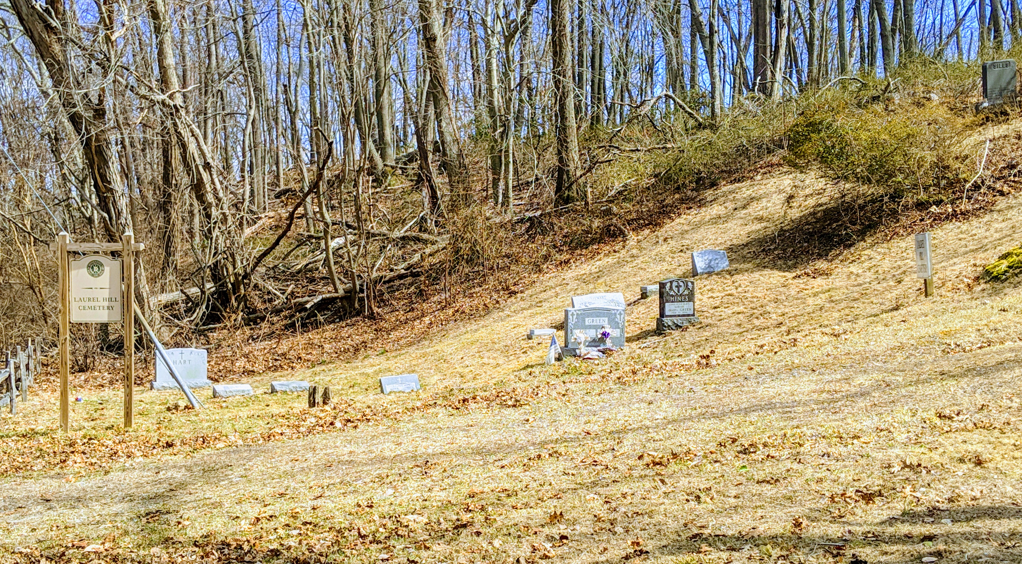
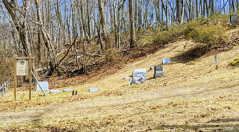
English: Bethel-Christian_Avenue-LaurelHill_Cemetery Historic district, sign on Christian Ave at cemetery |
Date | |
Source | Own work |
Author | CaptJayRuffins |
Camera location | 40° 56′ 29.53″ N, 73° 07′ 11.28″ W | View this and other nearby images on: OpenStreetMap | 40.941535; -73.119800 |
---|
Cemetery for people of color and Indigenous estb 1815
Licensing
I, the copyright holder of this work, hereby publish it under the following license:
This file is licensed under the Creative Commons Attribution-Share Alike 4.0 International license.
- You are free:
- to share – to copy, distribute and transmit the work
- to remix – to adapt the work
- Under the following conditions:
- attribution – You must give appropriate credit, provide a link to the license, and indicate if changes were made. You may do so in any reasonable manner, but not in any way that suggests the licensor endorses you or your use.
- share alike – If you remix, transform, or build upon the material, you must distribute your contributions under the same or compatible license as the original.
Items portrayed in this file
depicts
30 March 2019
40°56'29.526"N, 73°7'11.280"W
2,988,252 byte
1,950 pixel
3,533 pixel
image/jpeg
e51af5186e2d3bac3bcadb96076835d3d2f743f1
0.000767 second
1.8
4.44 millimetre
File history
Click on a date/time to view the file as it appeared at that time.
Date/Time | Thumbnail | Dimensions | User | Comment | |
---|---|---|---|---|---|
current | 16:00, 30 March 2019 | 3,533 × 1,950 (2.85 MB) | CaptJayRuffins | User created page with UploadWizard |
File usage
The following page uses this file:
Metadata
This file contains additional information, probably added from the digital camera or scanner used to create or digitize it.
If the file has been modified from its original state, some details may not fully reflect the modified file.
Camera manufacturer | |
---|---|
Camera model | Pixel 3 XL |
ISO speed rating | 57 |
F-number | f/1.8 |
Exposure time | 767/1,000,000 sec (0.000767) |
Lens focal length | 4.44 mm |
Date and time of data generation | 14:03, 28 March 2019 |
Latitude | 40° 56′ 29.76″ N |
Longitude | 73° 7′ 12.64″ W |
Altitude | 21.616 meters below sea level |
Width | 3,533 px |
Height | 1,950 px |
Software used | |
File change date and time | 08:21, 30 March 2019 |
Orientation | Normal |
Y and C positioning | Centered |
Horizontal resolution | 72 dpi |
Vertical resolution | 72 dpi |
Exposure Program | Normal program |
Sensing method | One-chip color area sensor |
DateTimeDigitized subseconds | 295192 |
DateTimeOriginal subseconds | 295192 |
DateTime subseconds | 295192 |
Subject distance range | Distant view |
Sharpness | Normal |
Flash | Flash did not fire, compulsory flash suppression |
Saturation | Normal |
Contrast | Normal |
Metering mode | Center weighted average |
Scene capture type | Standard |
Subject distance | 4.754 meters |
Focal length in 35 mm film | 27 mm |
Maximum land aperture | 1.7 APEX (f/1.8) |
Date and time of digitizing | 14:03, 28 March 2019 |
Exposure bias | 0 |
Digital zoom ratio | 1.5 |
White balance | Auto white balance |
APEX brightness | 7.86 |
Exposure mode | Auto exposure |
APEX aperture | 1.7 |
Meaning of each component |
|
Color space | sRGB |
Scene type | A directly photographed image |
Custom image processing | Custom process |
Shutter speed | 10.35 |
Exif version | 2.2 |
Supported Flashpix version | 1 |
GPS time (atomic clock) | 18:02 |
Measurement precision | Poor (7.42) |
GPS date | 28 March 2019 |
GPS tag version | 0.0.2.2 |