
File:Latium et Campania.png
Size of this preview: 800 × 568 pixels. Other resolutions: 320 × 227 pixels | 640 × 454 pixels | 1,024 × 727 pixels | 1,158 × 822 pixels.
Original file (1,158 × 822 pixels, file size: 7.38 MB, MIME type: image/png)
| This is a file from the Wikimedia Commons. Information from its description page there is shown below. Commons is a freely licensed media file repository. You can help. |
Summary
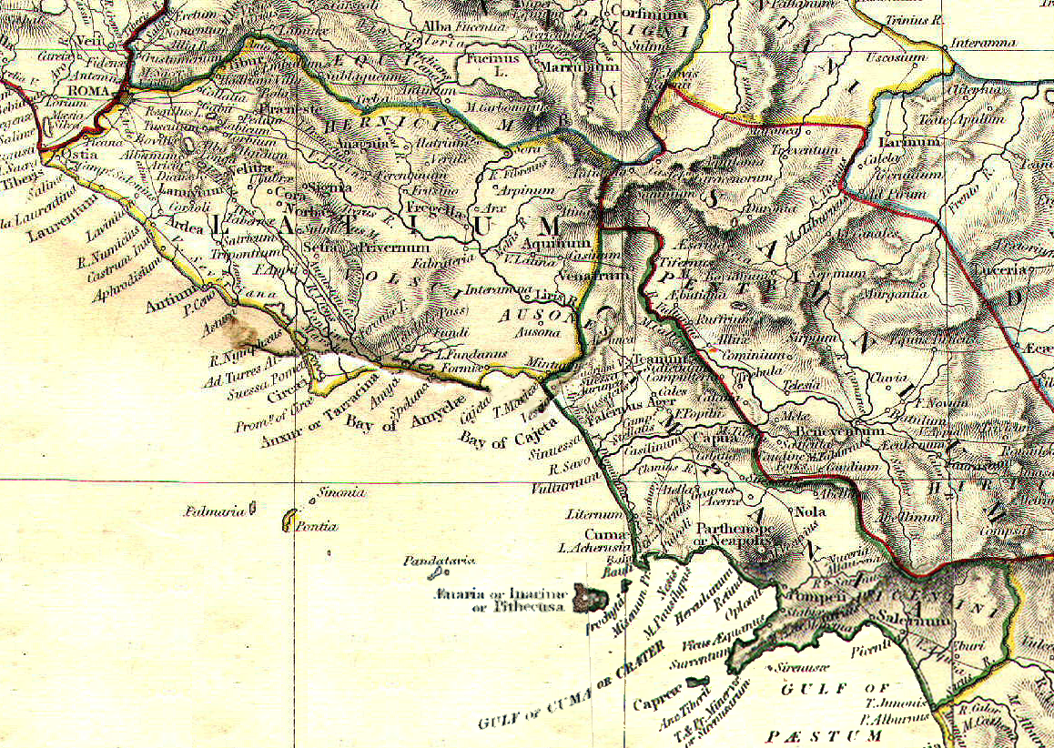
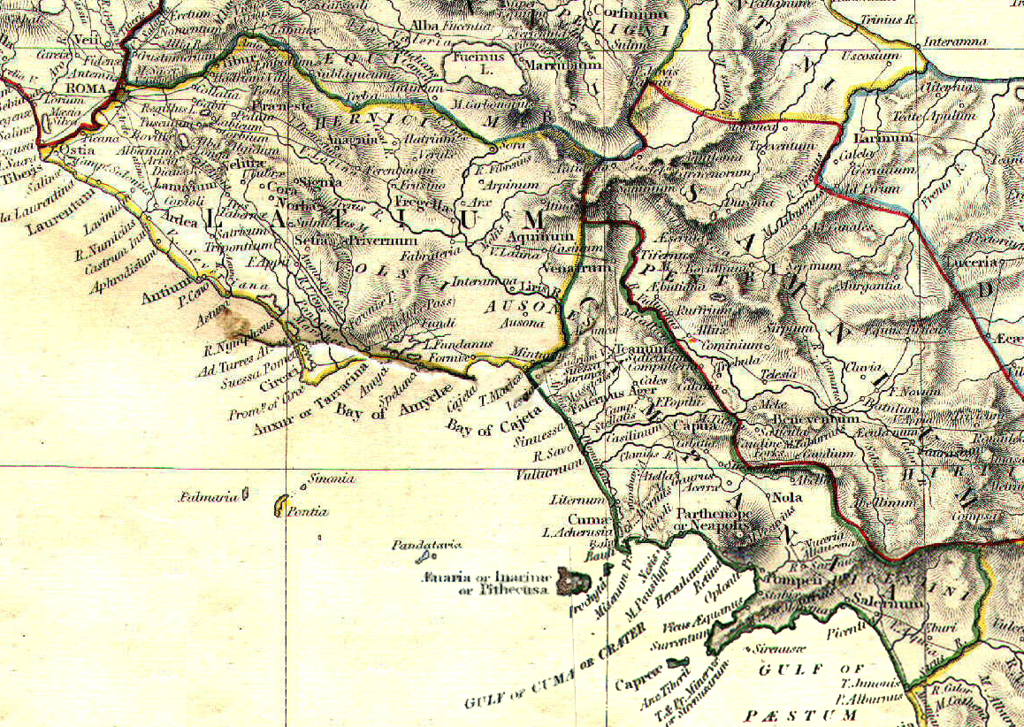
| Description | Reference map for Roman Empire Regium I Latium et Campania | |||||||||||||||||||||||
| Date | ||||||||||||||||||||||||
| Source | The Historical Atlas by William R. Shepherd, 1911 | |||||||||||||||||||||||
| Author |
|
|||||||||||||||||||||||
| Permission (Reusing this file) |
public domain because its copyright has expired | |||||||||||||||||||||||
.png)
Licensing
|
This work is in the public domain in its country of origin and other countries and areas where the copyright term is the author's life plus 70 years or fewer. | |
| This file has been identified as being free of known restrictions under copyright law, including all related and neighboring rights. | |
File history
Click on a date/time to view the file as it appeared at that time.
| Date/Time | Thumbnail | Dimensions | User | Comment | |
|---|---|---|---|---|---|
| current | 12:06, 1 May 2008 | | 1,158 × 822 (7.38 MB) | GlióPanteco | {{Information |Description=Reference map for Roman Empire Regium I Latium et Campania |Source=''The Historical Atlas'' by William R. Shepherd, 1911 |Date=May 1st 2008 |Author=William R. Shepherd |Permission=public domain because its copyright has expired |
File usage
The following pages on the English Wikipedia use this file (pages on other projects are not listed):
Global file usage
The following other wikis use this file:
- Usage on ar.wikipedia.org
- Usage on bg.wikipedia.org
- Usage on da.wikipedia.org
- Usage on es.wikipedia.org
- Usage on et.wikipedia.org
- Usage on fi.wikipedia.org
- Usage on fr.wikipedia.org
- Usage on id.wikipedia.org
- Usage on it.wikipedia.org
- Napoli
- Sperlonga
- Calvi Risorta
- Alatri
- Anagni
- Aquino
- Arpino
- Atina
- Trevi nel Lazio
- Cori
- Priverno
- Sezze
- Castel Volturno
- Cales
- Ariccia
- Lanuvio
- Palestrina
- Velletri
- Cuma
- Atella (città antica)
- Capua (città antica)
- Roma (città antica)
- Gaeta
- Forum Appii
- Bovillae
- Oplontis
- Giugliano in Campania
- Terracina
- Nuceria Alfaterna
- Stabia
- Avella
- Vescia (città)
- Pentapoli aurunca
- Lavinio (città antica)
- Ceccano
- Crustumerium
- Miseno (Bacoli)
- Fondi
- Formia
- Segni (Italia)
View more global usage of this file.