
File:Kirovograd oblast location map.svg

Size of this PNG preview of this SVG file: 533 × 291 pixels. Other resolutions: 320 × 175 pixels | 640 × 349 pixels | 1,024 × 559 pixels | 1,280 × 699 pixels | 2,560 × 1,398 pixels.
Original file (SVG file, nominally 533 × 291 pixels, file size: 67 KB)
| This is a file from the Wikimedia Commons. Information from its description page there is shown below. Commons is a freely licensed media file repository. You can help. |
Summary
| Description |
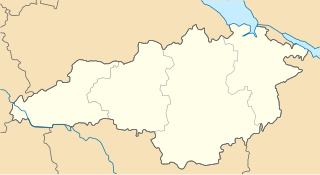
Русский: Районы Кировоградской области с 17 июля 2020 года |
| Date | |
| Source | Own work |
| Author | RosssW |
Licensing
I, the copyright holder of this work, hereby publish it under the following license:
This file is licensed under the Creative Commons Attribution-Share Alike 4.0 International license.
- You are free:
- to share – to copy, distribute and transmit the work
- to remix – to adapt the work
- Under the following conditions:
- attribution – You must give appropriate credit, provide a link to the license, and indicate if changes were made. You may do so in any reasonable manner, but not in any way that suggests the licensor endorses you or your use.
- share alike – If you remix, transform, or build upon the material, you must distribute your contributions under the same or compatible license as the original.
File history
Click on a date/time to view the file as it appeared at that time.
| Date/Time | Thumbnail | Dimensions | User | Comment | |
|---|---|---|---|---|---|
| current | 13:06, 7 August 2020 | | 533 × 291 (67 KB) | RosssW | Uploaded own work with UploadWizard |
File usage
The following 58 pages use this file:
- Adzhamka
- Bereslavka, Ukraine
- Blahovishchenske
- Bobrynets
- Dobrovelychkivka
- Dolynska
- Furmanivka, Kirovohrad Oblast
- Haidamatske, Kirovohrad Oblast
- Haivoron
- Holovanivsk
- Holovkivka, Kirovohrad Oblast
- Inhuletske
- Kamianets, Kirovohrad Oblast
- Kanatovo (air base)
- Kapitanivka, Kirovohrad Oblast
- Kirovohrad Oblast Football Federation
- Kropyvnytske
- Kropyvnytskyi urban hromada
- Lisove, Kirovohrad Oblast
- List of cities in Kirovohrad Oblast
- Mala Vyska
- Molodizhne, Kirovohrad Oblast
- Moshoryne
- Nova Praha
- Nove, Kirovohrad Oblast
- Novoarkhanhelsk
- Novomyrhorod
- Novooleksandrivka, Znamianka urban hromada, Kropyvnytskyi Raion, Kirovohrad Oblast
- Novoukrainka
- Oleksandriia
- Oleksandriiske
- Oleksandrivka, Oleksandrivka settlement hromada, Kropyvnytskyi Raion, Kirovohrad Oblast
- Onufriivka
- Pantaivka
- Pavlysh
- Petrove
- Petrove, Znamianka urban hromada, Kropyvnytskyi Raion, Kirovohrad Oblast
- Pobuzke
- Pomichna
- Pryiutivka
- Salkove, Kirovohrad Oblast
- Smoline
- Sokilnyky, Kirovohrad Oblast
- Subottsi
- Svitlovodsk
- Tarasivka, Oleksandrivka settlement hromada, Kropyvnytskyi Raion, Kirovohrad Oblast
- Ustynivka
- Vilshanka
- Vlasivka, Kirovohrad Oblast
- Vodiane, Znamianka urban hromada
- Volodymyrivka (Subottsi rural hromada)
- Vysoki Bairaky
- Zavallia, Kirovohrad Oblast
- Zdorivka, Kirovohrad Oblast
- Znamianka, Kirovohrad Oblast
- Znamianka Druha
- Module:Location map/data/Ukraine Kirovohrad Oblast
- Module:Location map/data/Ukraine Kirovohrad Oblast/doc
Global file usage
The following other wikis use this file:
- Usage on be.wikipedia.org
- Крапыўныцкы
- Шаблон:На карце/Украіна Кіраваградская вобласць
- Смолінэ
- Памічна
- Далынска
- Пэтровэ (Алэксандрыйскі раён)
- Навамыргарад
- Нава Прага
- Мала Выска
- Новаўкраінка
- Знам’янка
- Галубіевычы (Народыцкі раён)
- Елызавэтградка
- Устыніўка
- Салькавэ
- Алэксандрыўка (Кіраваградская вобласць)
- Алэксандрыйскэ
- Галаваніўск
- Добравэлычкіўка
- Власіўка
- Балахіўка
- Ануфрыіўка
- Паўлыш
- Прыюціўка
- Новаархангельск
- Навэ (Кіраваградская вобласць)
- Пантаіўка
- Пабузкэ
- Наўгародка
- Маладзіжнэ (Кіраваградская вобласць)
- Лісавэ
- Капітаніўка
- Кампанііўка
- Завалля
- Знам’янка Друга
- Грамадскэ (Кіраваградская вобласць)
- Підвысокэ (Новаархангельскі раён)
- Малыніўка (Пэтрыўскі раён)
- Навасілка (Галаваніўскі раён)
- Підгайці (Крапыўныцкі раён)
- Сэмэніўка (Кампанііўскі раён)
- Сакільныкы (Знам’янскі раён)
- Вэрбіўка (Новаархангельскі раён)
- Вэрбіўка (Новаўкраінскі раён)
- Вэрхіўці (Крапыўныцкі раён)
- Вэрбовэ (Галаваніўскі раён)
- Вэрбовэ (Кампанііўскі раён)
- Бэрэслаўка
- Usage on ce.wikipedia.org
View more global usage of this file.