
File:JRCC Halifax 02.jpg

Original file (3,264 × 1,836 pixels, file size: 1.13 MB, MIME type: image/jpeg)
| This is a file from the Wikimedia Commons. Information from its description page there is shown below. Commons is a freely licensed media file repository. You can help. |
Summary
| Description |
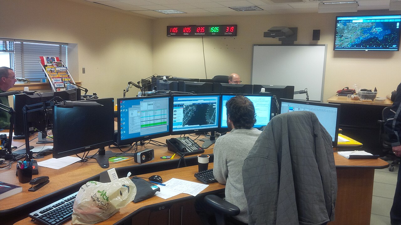
English: The Joint Rescue Coordination Centre Halifax (JRCC Halifax) is a rescue coordination centre operated by the Royal Canadian Air Force (RCAF) and the Canadian Coast Guard (CCG).
JRCC Halifax is responsible for coordinating the Search and Rescue (SAR) response to air and marine incidents within the Halifax Search and Rescue Region (SRR). This region covers areas of the Atlantic Ocean west of 30° west longitude, north of 42° north latitude and south of 70° north latitude. It includes the land mass of eastern Canada comprising the entirety of Newfoundland and Labrador, Prince Edward Island, New Brunswick, Nova Scotia, the eastern half of Quebec, and the southern half of Baffin Island. This area measures 4.7 million km2 of which approximately 80% is water. As a secondary role, JRCC Halifax coordinates requests by other levels of government for federal SAR resources. These secondary request are commonly made for humanitarian reasons that fall within provincial or municipal jurisdiction (e.g., searching for missing hunters, hoisting injured hikers and medical evacuation when civilian agencies are unable due to weather or location). |
| Date | |
| Source | Own work |
| Author | Ken Heaton |
| Camera location | | View this and other nearby images on: OpenStreetMap |
|---|
Licensing
- You are free:
- to share – to copy, distribute and transmit the work
- to remix – to adapt the work
- Under the following conditions:
- attribution – You must give appropriate credit, provide a link to the license, and indicate if changes were made. You may do so in any reasonable manner, but not in any way that suggests the licensor endorses you or your use.
- share alike – If you remix, transform, or build upon the material, you must distribute your contributions under the same or compatible license as the original.
File history
Click on a date/time to view the file as it appeared at that time.
| Date/Time | Thumbnail | Dimensions | User | Comment | |
|---|---|---|---|---|---|
| current | 21:27, 12 January 2019 | | 3,264 × 1,836 (1.13 MB) | Ken Heaton | User created page with UploadWizard |
File usage
The following page uses this file: