
File:African map 1885.jpg
Size of this preview: 483 × 600 pixels. Other resolutions: 193 × 240 pixels | 387 × 480 pixels | 619 × 768 pixels | 825 × 1,024 pixels | 1,400 × 1,738 pixels.
Original file (1,400 × 1,738 pixels, file size: 793 KB, MIME type: image/jpeg)
| This is a file from the Wikimedia Commons. Information from its description page there is shown below. Commons is a freely licensed media file repository. You can help. |
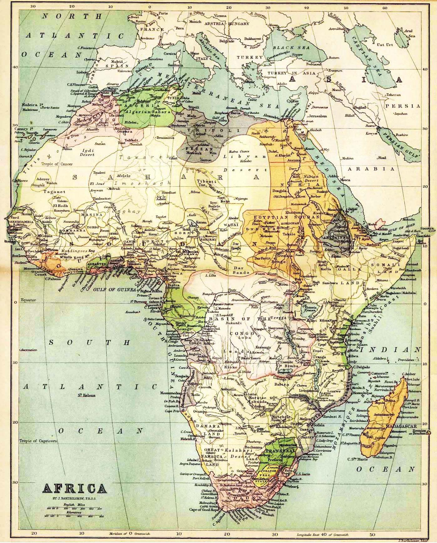
| Description | Historical map of Africa by J. Bartholomew, F.R.G.S. John Bartholomew (1831 – 1893), a Scottish cartographer, born in Edinburgh. The image shows a political map with the knowledge about Africa in the year 1885. | ||||
| Source | http://www.nationsonline.org/oneworld/map/africa-historical-map-1885.htm | ||||
| Author | J. Bartholomew | ||||
| Permission (Reusing this file) |
|
||||
| Other versions |
 |
||||
File history
Click on a date/time to view the file as it appeared at that time.
| Date/Time | Thumbnail | Dimensions | User | Comment | |
|---|---|---|---|---|---|
| current | 00:43, 8 November 2009 | | 1,400 × 1,738 (793 KB) | Feydey | {{Information |Description=Historical map of Africa by J. Bartholomew, F.R.G.S. John Bartholomew (1831 – 1893), a Scottish cartographer, born in Edinburgh. The image shows a political map with the knowledge about Africa in the year 1885. |Source=http:// |
File usage
The following page uses this file:
Global file usage
The following other wikis use this file:
- Usage on es.wikipedia.org
- Usage on fr.wikipedia.org