File:Acisoma inflatum 2017 11 28 1169.jpg
Page contents not supported in other languages.
Tools
Actions
General
In other projects
Appearance
Size of this preview: 787 × 600 pixels. Other resolutions: 315 × 240 pixels | 630 × 480 pixels | 1,008 × 768 pixels | 1,333 × 1,016 pixels.
Original file (1,333 × 1,016 pixels, file size: 253 KB, MIME type: image/jpeg)
This is a file from the Wikimedia Commons. Information from its description page there is shown below. Commons is a freely licensed media file repository. You can help. |
Summary
DescriptionAcisoma inflatum 2017 11 28 1169.jpg |
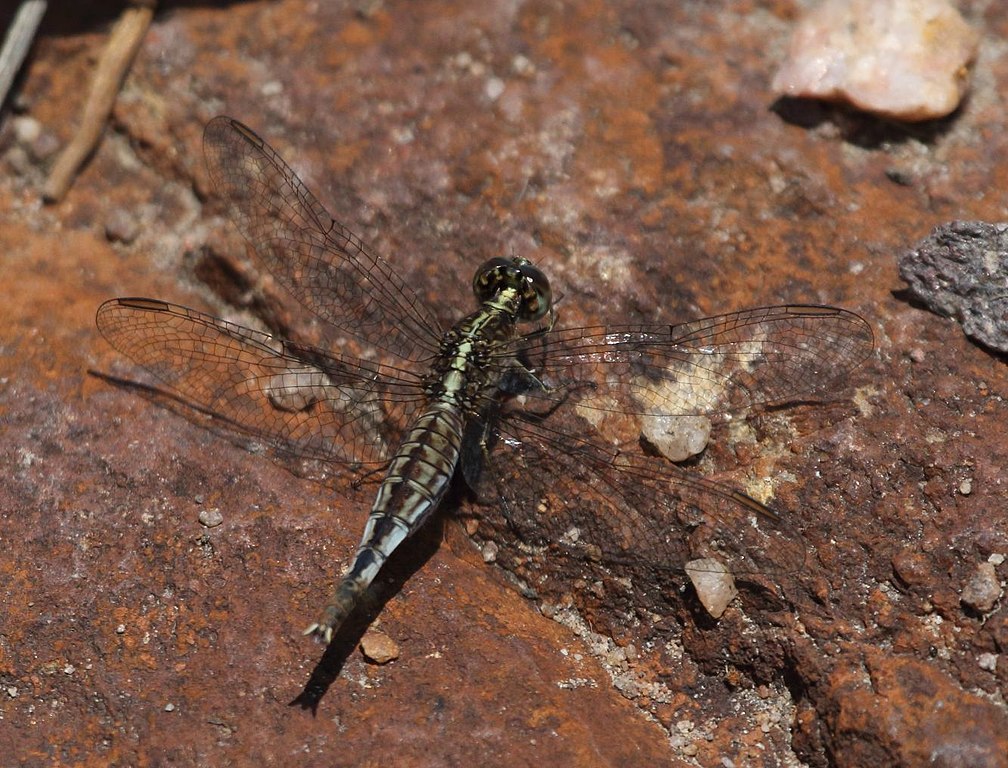
English: Female stout pintail Acisoma inflatum at Welgevonden Game Reserve, Limpopo, South Africa. http://vmus.adu.org.za/?vm=OdonataMAP-39248 |
Date | |
Source | Own work |
Author | Alandmanson |
Camera location | 24° 18′ 20.61″ S, 27° 53′ 44.03″ E | View this and other nearby images on: OpenStreetMap | -24.305725; 27.895565 |
---|
Licensing
I, the copyright holder of this work, hereby publish it under the following license:
This file is licensed under the Creative Commons Attribution 4.0 International license.
- You are free:
- to share – to copy, distribute and transmit the work
- to remix – to adapt the work
- Under the following conditions:
- attribution – You must give appropriate credit, provide a link to the license, and indicate if changes were made. You may do so in any reasonable manner, but not in any way that suggests the licensor endorses you or your use.
Items portrayed in this file
depicts
28 November 2017
24°18'20.610"S, 27°53'44.034"E
image/jpeg
d63c1be7e83d515575ef41f1862de9b415e88577
258,588 byte
1,016 pixel
1,333 pixel
File history
Click on a date/time to view the file as it appeared at that time.
Date/Time | Thumbnail | Dimensions | User | Comment | |
---|---|---|---|---|---|
current | 12:56, 7 December 2017 | 1,333 × 1,016 (253 KB) | Alandmanson | User created page with UploadWizard |
File usage
The following page uses this file:
Metadata
This file contains additional information, probably added from the digital camera or scanner used to create or digitize it.
If the file has been modified from its original state, some details may not fully reflect the modified file.
Camera manufacturer | Canon |
---|---|
Camera model | Canon EOS 7D Mark II |
Author | Alan Manson |
Exposure time | 1/2,500 sec (0.0004) |
F-number | f/8 |
ISO speed rating | 400 |
Date and time of data generation | 11:07, 28 November 2017 |
Lens focal length | 400 mm |
Latitude | 24° 18′ 20.61″ S |
Longitude | 27° 53′ 44.03″ E |
Altitude | 1,192 meters above sea level |
Orientation | Normal |
Horizontal resolution | 350 dpi |
Vertical resolution | 350 dpi |
Software used | Digital Photo Professional |
File change date and time | 11:07, 28 November 2017 |
Y and C positioning | Centered |
Exposure Program | Aperture priority |
Exif version | 2.3 |
Date and time of digitizing | 11:07, 28 November 2017 |
Meaning of each component |
|
Shutter speed | 11.375 |
APEX aperture | 6 |
Exposure bias | −0.66666666666667 |
Metering mode | Pattern |
Flash | Flash did not fire, compulsory flash suppression |
DateTime subseconds | 53 |
DateTimeOriginal subseconds | 53 |
DateTimeDigitized subseconds | 53 |
Supported Flashpix version | 1 |
Color space | sRGB |
Custom image processing | Normal process |
Exposure mode | Auto exposure |
White balance | Auto white balance |
Scene capture type | Standard |
GPS time (atomic clock) | 09:07:20.049 |
Satellites used for measurement | 24 |
Receiver status | Measurement in progress |
Measurement mode | 3-dimensional measurement |
Measurement precision | Poor (3.8) |
Reference for direction of image | Magnetic direction |
Geodetic survey data used | WGS-84 |
GPS date | 28 November 2017 |
GPS tag version | 0.0.3.2 |
Rating (out of 5) | 1 |