
File:1906TractMapDowntownLosAltos.jpg
No higher resolution available.
1906TractMapDowntownLosAltos.jpg (500 × 500 pixels, file size: 212 KB, MIME type: image/jpeg)
| This is a file from the Wikimedia Commons. Information from its description page there is shown below. Commons is a freely licensed media file repository. You can help. |
Summary
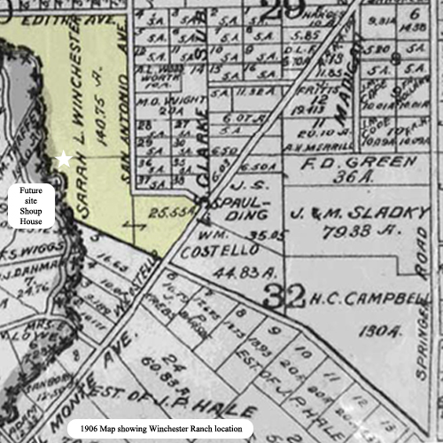
| Description | 1906 Tract Map of Mountain View, California showing site of Winchester Ranch: future site of Los Altos. |
| Date | |
| Source |
Taken from City of Los Altos Historic Resources Inventory, Section II. Completed 1997. Patricia Leach. Photo from Los Altos History Museum Archives. |
| Author | Unknown author |
Licensing
This media file is in the public domain in the United States. This applies to U.S. works where the copyright has expired, often because its first publication occurred prior to January 1, 1929, and if not then due to lack of notice or renewal. See this page for further explanation.
|
 | |
 |
Original upload log
The original description page was here. All following user names refer to en.wikipedia.
| Date/Time | Dimensions | User | Comment |
|---|---|---|---|
| 2011-10-11 20:05:40 | 500× 500× | Wjenning | 1906 Tract Map of Mountain View, California showing site of Winchester Ranch: future site of Los Altos. Taken from City of Los Altos Historic Resources Inventory, Section II. Completed 1997. Patricia Leach. Photo from Los Altos History Museum Archives. |
File history
Click on a date/time to view the file as it appeared at that time.
| Date/Time | Thumbnail | Dimensions | User | Comment | |
|---|---|---|---|---|---|
| current | 08:32, 12 July 2016 | | 500 × 500 (212 KB) | FastilyClone | Transferred from en.wikipedia (MTC!) |
File usage
The following 2 pages use this file: